It has been ages since humans looked up at the sky to navigate. Ancient explorers from the Mediterranean region, for instance, relied heavily on constellations to help orient themselves and their ships.
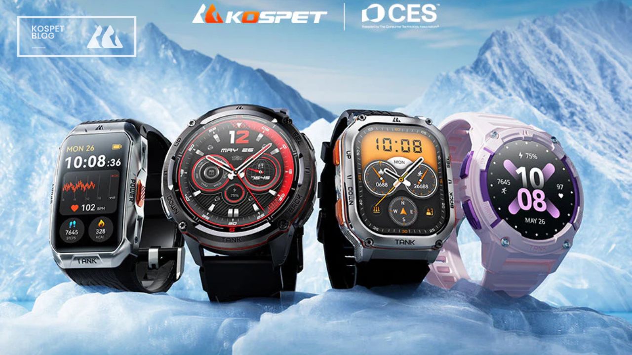
Nowadays GPS technology is woven into almost every aspect of our modern life. It is deployed in a large number of mission-critical applications, from agriculture to construction, from exploration to navigation. You can also find GPS systems in compatible KOSPET smart wearable devices, including TANK T3 ULTRA 2 , TANK S2 , and TANK M3 ULTRA smartwatches and TANK X2 ULTRA smart band.
What Is GPS and How Does It Work
The Global Positioning System (or GPS), which currently consists of at least 24 operational satellites , is a satellite-based radio navigation system owned by the U.S. government. With no subscription fees or setup charges, GPS works at all times and in nearly all weather conditions. Originally intended for military applications, the GPS system was made available for civilian use in the 1980s.
GPS satellites circle the Earth about twice a day in a quite precise orbit and each sends out signal information back to the Earth. GPS receivers utilize this information and triangulation to calculate your exact location. Essentially, the GPS receiver compares the time a signal was transmitted by a satellite with the time it was received. The time difference tells the GPS receiver how far away it is from the satellite. With distance measurements from a few more satellites, the GPS receiver can determine your location and display it electronically to record your workout routes, guide you back to the starting location, or adventure off the beaten track.
To calculate your 2D position (latitude and longitude) and track your movement, a receiver must be locked on to the signal of at least three satellites. With four or more satellites in view, the receiver can determine your 3D position (latitude, longitude, and altitude). Once your position has been determined, the GPS unit can calculate speed, trip distance, distance to destination, and other information.
What Are the Advantages of KOSPET Smartwatches Compatible with GPS
Cyclists, hikers, and explorers of all types can power through with KOSPET smartwatches or smart band that features L1 and L5 satellite signals to maintain signal strength and consistency for accurate GPS tracking, and 6 satellite navigation systems for reliable coverage, which is unhindered by environmental interference or the smart wearable’s robust full-metal rugged body.
Dual-band GPS Tracking
The GPS system mainly uses two frequency bands – L1 and L5. Single-frequency GPS devices can only receive satellite signals transmitted on the L1 frequency band, while dual-frequency GPS devices can pick up satellite signals from both L1 and L5 frequency bands.
Whether you are commuting in the concrete jungle or hiking a tree-covered trail, some of the industry’s best GPS smartwatches and smart bands from KOSPET have your back by boasting L1 and L5 satellite signals for GPS tracking that offer:
- More accurate navigational positioning when you use the wearable device in challenging environments, such as dense downtown areas.
- Accuracy within about +/- 2 meters (or 6 feet) under ideal conditions versus the +/- 3 meters (or 10 feet) accuracy of other smart wearables.
- More precise tracking compared to a single-frequency receiver by better detecting and rejecting satellite signals.
- Capability of rejecting atmospheric effects on the GPS signals.
The illustrations below demonstrate how dual-frequency systems outperform in filtering out inaccurate signals reflecting off of trees, mountains, or buildings.

Six Satellite Positioning Systems
GPS is a satellite navigation system with global coverage. There are other systems similar to GPS in the world, all of which are categorized as global navigation satellite systems (or GNSS). Apart from GPS , compatible KOSPET smart wearables track Russia's Global Navigation Satellite System ( GLONASS ), China's BeiDou Navigation Satellite System (BDS), the European Union's Galileo , Japan's Quasi-Zenith Satellite System ( QZSS ), and Indian Regional Navigation Satellite System ( IRNSS , with an operational name of NavIC ).

KOSPET GPS smartwatches harness six satellite positioning systems for broader coverage, higher accuracy, and more reliability.
Wherever your journey takes you, from mountaineering to snowboarding, support for six satellite positioning systems allows your KOSPET smartwatch or smart band with GPS to pinpoint your location with precision.
How Do KOSPET GPS Smartwatches Elevate Your Outdoor Adventures
As groundbreaking as the support for 170+ sports modes, KOSPET smartwatches or smart band serves to help you make the most of your outdoor workouts and explorations with the features as follows:
Record Your Workout Routes
Thanks to its strong and reliable GPS tracking, your KOSPET GPS smart wearable can record the routes you take and trails you run with ease and precision, making it among the best GPS running smartwatches.

Check your real-time workout route from the wrist.
Back to Your Starting Location
Anytime during an outdoor exercise, you can use the Route back feature (currently supported on KOSPET TANK T3 ULTRA 2 , TANK X2 ULTRA , and TANK S2 ) to return to the area you came from or anywhere you traveled.
Enter the Workout list on your compatible KOSPET smartwatch or smart band with GPS, and start an outdoor exercise. At any time during the workout, swipe right on the screen and select Straight-line Return or Route Back to return to your starting point in a straight line or along the path you passed through.

Head back to the starting point anytime during an outdoor exercise – in a straight line or along the path traveled.
View More Performance Data in the KOSPET FIT App
Capture and share more physical and workout records in the compatible KOSPET FIT App, ranging from movement distance to average pace, from calorie consumption to route information, and even beyond. Make every move count and stride towards a more active lifestyle.
Go to the KOSPET FIT App for further details about your workout, the route, etc.
To download the KOSPET FIT App, please visit the Apple App Store for iOS or the Google Play Store for Android. You can also go to Settings > QR Code on your KOSPET smart wearable and download the App by scanning the code with your smartphone.
Special Notes
- Indoor position tracking is not supported. Positioning speed and accuracy may depend on the surrounding environment. The number of simultaneous satellite connections and specific satellite connections may be affected by your location.
- Due to environmental factors, the straight line back to your starting location shown on the smartwatch or the smart band may not be a practical route to follow, which only aims to help you keep track of your position in relation to the starting point of your outdoor workout.
- The features of GPS workout route records and route back are compatible with these 7 sports modes: Outdoor walking, Outdoor running, Outdoor cycling, Mountaineering, Snowboarding, Trail running, and Cross-country skiing.