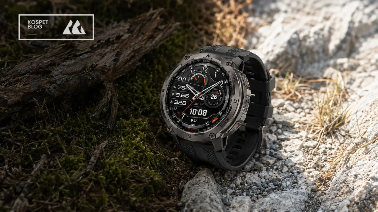



Yes. An outdoor smartwatch can navigate without cell service when it has built-in GNSS and the required map or route has been saved before the hike. Satellite positioning works independently of cellular coverage, but downloading maps, syncing new routes, receiving live updates, and sending messages may still require a connection.
Before heading off-grid, download the correct map area, verify your route, and make sure the continuous GPS runtime covers the hike. If you are still choosing a device, browse our outdoor smartwatch collection to compare offline navigation, GPS performance, battery life, and durability.

What Does an Outdoor Smartwatch Need to Navigate Offline?
Offline navigation relies on three elements: independent satellite positioning, locally stored navigation data, and enough battery to keep GPS active throughout the route.
Built-In GNSS
GNSS is the broader term for satellite-positioning systems, including GPS. A watch with its own GNSS receiver can calculate its position without borrowing location data from a connected phone.
This is why your phone can show “No Service” while the position marker on your watch continues to move. The watch is receiving positioning signals from satellites rather than relying on nearby cell towers.
Offline Maps or Saved Routes
Position and map are not the same thing. According to GPS.gov, satellites provide positioning signals rather than the maps displayed on consumer devices. Trail details and directions must come from data already stored on the watch.
Imagine reaching a three-way junction after losing cellular coverage. The watch may still know your coordinates, but without a downloaded map or saved route, it may not show which path leads toward your destination.
GNSS tells the watch where you are. Offline navigation data shows where the trail goes.
Continuous GPS Battery Life
Everyday battery life and continuous GPS runtime measure different workloads. A watch may last several days when used for notifications and occasional health tracking, yet drain much faster while continuously receiving satellite signals and displaying navigation data.
For hiking, compare your expected route duration with the continuous GPS specification—not the general smartwatch battery estimate.
What Should You Download Before an Off-Grid Hike?
Offline navigation becomes reliable before the hike begins. Waiting until the trailhead to download a map creates an unnecessary risk, especially when mobile reception is already weak.
Offline Map
An offline map shows nearby trails, junctions, and geographic context. Download an area wider than the exact route. A closure, storm, or missed turn could force you beyond the original course, leaving a narrowly downloaded map blank when you need it most.
GPX or KML Route
A GPX or KML file marks the course you intend to follow. It may contain the trailhead, destination, turns, and waypoints. Use a trusted route source and check recent information from the relevant park or trail authority before departure.
A route file and an offline map work best together. The route shows where you planned to go; the map reveals what surrounds it. That context becomes valuable when a path is blocked or you need another way out.
Breadcrumb Navigation and Track Back
Breadcrumb navigation shows a simplified course or recorded track. It can help you remain on the planned line, although it may not display the surrounding paths and terrain found on a full offline map.
Track Back uses the path recorded during the activity to guide you toward the starting point. It is useful when you turn around early or can no longer recognize the return route.
Pre-Hike Navigation Check
1. Download the map. Cover the complete trail, nearby junctions, and possible exit routes.
2. Import the route. Load the GPX or KML file and confirm the trailhead, destination, and direction of travel.
3. Compare the route with the map. A successful file transfer does not guarantee that the route is current or correctly aligned.
4. Test the watch offline. Disable mobile data or disconnect the phone, then confirm that the map and route still open.
5. Prepare a backup. Charge the watch and keep another offline map on your phone. The NPS Ten Essentials also recommends knowing how to use a map, compass, or GPS unit and carrying a physical map as a backup.
How Does the KOSPET TANK T4 Navigate Offline?
The KOSPET TANK T4 provides a practical example of this process. It combines dual-band, six-system GNSS with offline maps and supports GPX or KML route import through the Apexmove app.

KOSPECT TANK Reloj inteligente T4
$209.99 USD
Pair the Watch with Apexmove
Connect the watch to Apexmove while Bluetooth and internet access are available. Preparing it at home gives you time to install updates, resolve connection issues, and confirm that the watch can receive navigation data.
Choose and Import the Route
Download a GPX or KML file from a trusted trail source. Before importing it, check official notices for closures, reroutes, or access restrictions.
Add the file to Apexmove and sync it to the watch. Once the transfer finishes, confirm that the course begins at the correct trailhead and follows the expected direction.
Download the Map Area
Save the region covering the planned route and nearby exit options. The interface may change after app or firmware updates, so follow the latest offline map guide when completing the setup.
Run an Offline Test
Disconnect the phone or disable mobile data. Open both the map and route on the watch. This verifies that the files were transferred to the device rather than temporarily loaded through an active connection.
Confirm the Position at the Trailhead
Give the watch time to establish a satellite fix before starting the activity. Check that the position marker matches the actual trailhead instead of a nearby road or parking area.
During the hike, use the map to compare your position with the saved route. At a confusing junction, zoom in and confirm that your movement continues along the intended path. If you turn back, Track Back can use the recorded trail to guide you toward the starting point.
Wrist navigation is particularly convenient when both hands are occupied with trekking poles. A quick glance can answer “Am I still on route?” without repeatedly retrieving your phone. When a closure or detour requires a new plan, however, the larger phone display offers more context.
What Can Limit an Outdoor Smartwatch on Remote Trails?
Offline maps remove dependence on cellular coverage, but they do not eliminate every source of error. Terrain, map quality, route files, screen size, unexpected detours, and battery use can all affect navigation.
| Potential problem | What may happen on the trail | What you can do |
|---|---|---|
| Dense forest or narrow canyon | Positioning may become slower or less stable. | Pause in a more open area before making an important route decision. |
| Old or incomplete map | A visible path may be missing, closed, or rerouted. | Check recent trail information and keep another map source. |
| GPX and map mismatch | The route line may not follow the displayed trail. | Compare the route and map before departure. |
| Small watch display | Complex terrain may be difficult to interpret. | Use the watch for quick checks and a larger map for major decisions. |
| Unexpected detour | The required map area may not be stored on the watch. | Download a wider region and identify possible exits in advance. |
| Low battery | Navigation and activity recording may stop together. | Start fully charged and maintain a realistic power reserve. |
Terrain Can Affect Positioning
Trees, cliffs, and other obstructions can block or reflect satellite signals. The official GPS accuracy guide lists trees, buildings, bridges, and reflected signals among the factors that can reduce positioning accuracy.
If the marker begins to jump or appears far from the trail, avoid making an immediate turn based on that single reading. Pause, move to a more open location when it is safe, and compare the watch with another navigation source.
Maps Can Become Outdated
An offline map cannot display changes published after the map file was created. A path on the ground may be missing from the watch, while a route shown on the screen may have been closed or redirected.
Check current trail conditions before the hike. Pay particular attention to temporary closures, seasonal restrictions, washed-out bridges, and changes caused by fire or severe weather.
Plan Around GPS Runtime
The TANK T4 list up to 15 days of typical use and up to 22 hours of continuous GPS use. Actual performance can vary with display use, settings, temperature, and other conditions.
For a planned ten-hour hike, do not treat the remaining twelve hours as disposable capacity. Slower progress, extra map checks, wrong turns, cold weather, and battery age can reduce the margin.
Required GPS runtime = planned hiking time + delay reserve + return margin.
Use the watch for frequent route checks, the phone for wider map context, and an independent backup when navigation failure could have serious consequences.
Can an Outdoor Smartwatch Replace Emergency Communication?
No. Determining your location and transmitting that location are separate functions.
A GPS-equipped watch may continue displaying coordinates after cellular coverage disappears. That does not mean it can send those coordinates to rescuers. Communication requires a cellular, radio, or satellite connection.
The KOSPET TANK T4 includes a short-range walkie-talkie with an advertised range of approximately 40 metres without internet. Environmental conditions can affect that range. The feature can help nearby group members communicate, but KOSPET does not describe it as satellite SOS or long-distance emergency messaging.
For remote or solo hiking, use several layers of protection: an outdoor smartwatch for route checks, an offline phone map for a larger secondary view, a shared itinerary and return time, and a paper map and compass where appropriate.
If the route requires off-grid emergency communication, carry a satellite communicator or Personal Locator Beacon. NOAA SARSAT explains that a 406 MHz distress beacon is designed to alert search-and-rescue authorities through a satellite-aided system. That is a different capability from displaying an offline trail map.
An outdoor smartwatch can navigate without cell service when it has independent GNSS, stored navigation data, and enough battery for the route. It works well for quick trail checks and following a prepared course, but it should not be treated as a complete emergency system or the only navigation resource on a remote hike.
FAQ
Will an Outdoor Smartwatch GPS Work If My Phone Is Turned Off?
Yes, if the watch has built-in GNSS. It can calculate its location without a connected phone. The map or route must still be stored on the watch to provide offline navigation. A model that relies on connected GPS may continue to need the phone.
Do I Need Both an Offline Map and a GPX Route?
Not always, but using both provides more context. A GPX route shows the course you intend to follow, while an offline map shows surrounding paths and terrain. If the route is blocked or you miss a turn, the map can help you evaluate nearby alternatives.
How Much GPS Battery Life Do I Need for Hiking?
Choose a continuous GPS runtime that exceeds the expected hike duration and leaves a meaningful reserve for delays. Check continuous GPS runtime rather than typical or standby battery life, and account for screen use, settings, temperature, and battery condition.
Can the KOSPET TANK T4 Send an SOS Without Cell Service?
The TANK T4 should not be treated as a satellite SOS device. Its short-range walkie-talkie supports nearby group communication without internet, but remote emergency communication requires a separate satellite communicator or Personal Locator Beacon.